

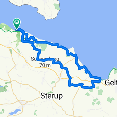
Wasser und Land Dänemark-Deutschland mit Fahrradfähre
A cycling route starting in Broager, Region South Denmark, Denmark.
Overview
About this route
Start ist der Hafen Egernsund, dann mit der Fahrradfähre nach Langballigau in Deutschland. Nun geht es um den Flensburgfjord zurück nach Dänemark. Fähre kann man vorher über Internet buchen denn die hat nur 12 Plätze
- -:--
- Duration
- 50 km
- Distance
- 502 m
- Ascent
- 502 m
- Descent
- ---
- Avg. speed
- 54 m
- Avg. speed

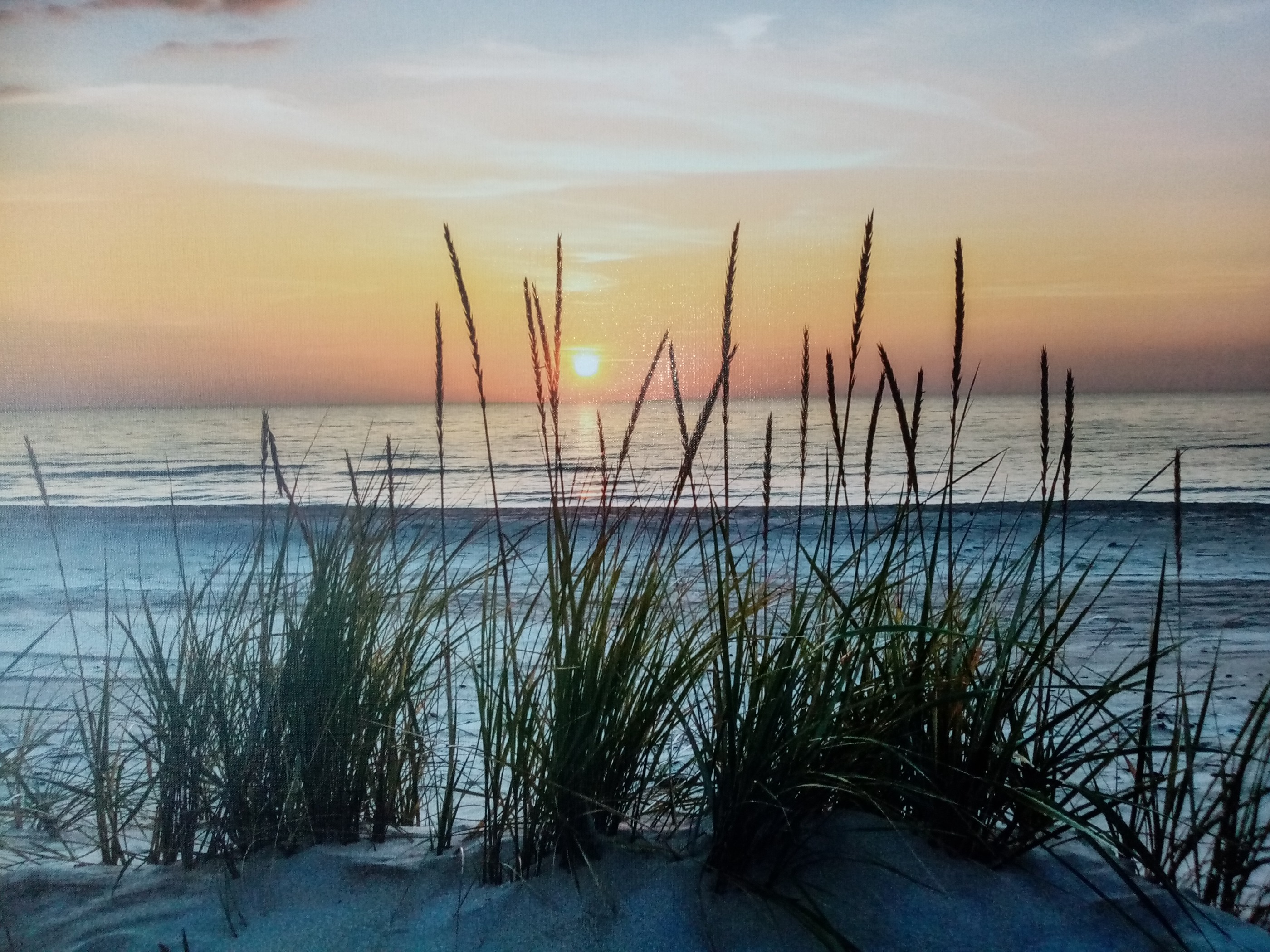
Route photos


Route quality
Waytypes & surfaces along the route
Waytypes
Quiet road
17.4 km
(35 %)
Path
10.4 km
(21 %)
Surfaces
Paved
41.1 km
(82 %)
Unpaved
6.9 km
(14 %)
Asphalt
37.8 km
(76 %)
Gravel
5.5 km
(11 %)
Continue with Bikemap
Use, edit, or download this cycling route
You would like to ride Wasser und Land Dänemark-Deutschland mit Fahrradfähre or customize it for your own trip? Here is what you can do with this Bikemap route:
Free features
- Save this route as favorite or in collections
- Copy & plan your own version of this route
- Sync your route with Garmin or Wahoo
Premium features
Free trial for 3 days, or one-time payment. More about Bikemap Premium.
- Navigate this route on iOS & Android
- Export a GPX / KML file of this route
- Create your custom printout (try it for free)
- Download this route for offline navigation
Discover more Premium features.
Get Bikemap PremiumFrom our community
Other popular routes starting in Broager
 От Strandweg 4, Westerholz до Strandweg 4, Westerholz
- Distance
- 4.2 km
- Ascent
- 61 m
- Descent
- 61 m
- Location
- Broager, Region South Denmark, Denmark
 Sløjfe 1C - Broagerland
- Distance
- 29.8 km
- Ascent
- 156 m
- Descent
- 156 m
- Location
- Broager, Region South Denmark, Denmark
 Wasser und Land Dänemark-Deutschland mit Fahrradfähre
- Distance
- 50 km
- Ascent
- 502 m
- Descent
- 502 m
- Location
- Broager, Region South Denmark, Denmark
 Nieby - Hasselberg
- Distance
- 28.2 km
- Ascent
- 145 m
- Descent
- 147 m
- Location
- Broager, Region South Denmark, Denmark
 Ostseeküstenradweg GPS-Track (vereinfacht)
- Distance
- 413.4 km
- Ascent
- 1,603 m
- Descent
- 1,619 m
- Location
- Broager, Region South Denmark, Denmark
 Lange Radrunde vom 10. September 11:23Langballigau,Hunhoi,kaleby,gintoft
- Distance
- 45.9 km
- Ascent
- 140 m
- Descent
- 140 m
- Location
- Broager, Region South Denmark, Denmark
 Route nach Langballig
- Distance
- 56.7 km
- Ascent
- 605 m
- Descent
- 585 m
- Location
- Broager, Region South Denmark, Denmark
 From Langballig to Gråsten
- Distance
- 50.4 km
- Ascent
- 496 m
- Descent
- 498 m
- Location
- Broager, Region South Denmark, Denmark
Open it in the app